EPC Project Management Software for More Efficient Execution
July 25, 2023
Reality Capture Services: Is It Worth It?
Many people in maintenance, real estate, or the Architecture, Engineering, and Construction (AEC) industry wonder if reality capture services is worth the trouble and cost. Our answer is a resounding “YES,” and we’d like to tell you why.
Before we can dig into the questions of relative value and ROI, let’s make sure we are all on the same page about what reality capture services are.
sed do eiusmod tempor incididunt ut labore et dolore magna aliqua. Ut enim ad minim veniam, quis nostrud exercitation ullamco laboris nisi ut aliquip ex ea commodo consequat. Duis aute irure dolor in reprehenderit in voluptate velit esse cillum dolore eu fugiat nulla pariatur. Excepteur sint occaecat cupidatat non proident, sunt in culpa qui officia deserunt mollit anim id est laborum.
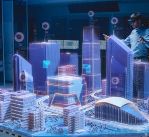
This is where reality capture services comes in. Using lasers (LiDAR to be precise) it is now possible to create a laser scan of a structure with down–to-the-millimeter accuracy. Then, after “capturing reality,” software can quickly render the data points (the point cloud) into a usable and highly accurate 3D model.
Alternatively, 3D models can be made by using photogrammetry techniques. As we explain on our blog, “Photogrammetry consists of taking pictures of space from different angles and distances to capture the tridimensional surface of objects. After capturing the data, those photos are imported into specialized photogrammetry software for further processing, resulting in a 3D model.”
And outdoors, there is excellent reality capture work being done with the help of unmanned aerial vehicles (UAVs), more commonly referred to as drones. Drone technology can take aerial photos of any area or environment from different angles and heights, and then be combined with others reality capture techniques to create a precise map or Point Cloud of any area more quickly and cost-effectively. That point cloud can be rendered as a 3D model.
Those 3D models can be used for many applications, from as-built BIM models to engineering schematics. They can be used for virtual site visits, for construction progress tracking, and more.
Because they are LASER accurate (literally), they can provide incredibly detailed information about the structure. As Geo Week News puts it, “Reality capture gives you the best data available, helping you to make decisions based upon facts and not theory. This will improve the entire project from beginning to end.”
H3: How much does Reality Capture Services cost?
As with many software and services, when it comes to reality capture services, the price can vary widely. Many things can impact the pricing, from the size of the area to be scanned to the fees charged by outside survey teams. Overall, the price can range from a few hundred dollars to thousands, depending on the scale and scope of the project.
The same variance in price is true if you wish to purchase your own reality capture software and 3D scanning equipment. According to LiDARNews, “ A robust, entry-level LiDAR system comes in around $23,000” but there is no true top-end price, and “LiDAR processing software can be upwards of $20,000, but luckily you could start with open-source software for free.” So owning your own system can cost between zero dollars and range to as high as your budget can take you.
When it comes to reality capture from drones, A whitepaper by Autodesk explains that “the cost of scanning a site has dramatically reduced. Where it once took $40,000 to do a one-time scan of a site from a professional service company or LiDAR-equipped plane, you can now own a commercial drone starting at $1,500 and start flying a site on-demand.”
H2: Reality Capture ROI
There is remarkable evidence to suggest that reality capture services can provide a massive return on investment.
Consider that the costs of creating a similar building plan or model used to include the time, labor, and reworks that were associated with gathering the data and with rendering the models. A whitepaper by Autodesk quotes a reality capture user as saying “I estimate approximately a 50% reduction in cost by using 3D laser scanning vs. trying to capture all the same information with a traditional 2D surveyor. The biggest savings was the time savings.”
Laser scanners have the capacity to generate substantial returns. Engineering.com describes an architecture firm that “invested in a suite of reality capture technology and was able to reduce rework, collect and use accurate as-built models of typically inaccessible spaces, increase the quality of collaboration between project teams, improve the budgeting process and realize a 325 percent return on investment (ROI).”
If the numbers quoted above are accurate, then that means massive cost savings, and incredible ROI. I think it’s fair to say that reality capture is certainly worth it.
And the value is even higher with a powerful point cloud visualization software like the JP Interactive Viewer. To not only be able to easily visualize and manage 3D models, point clouds, and 360 images, but to be able to share them across your team in a cloud-native viewer makes the reality capture capabilities of JP Global Digital the best software in town.