September 16, 2022
Point clouds play a crucial role in modern engineering and business operations in general. These models provide an accurate and intricate 3D model of a structure, space, or object. In turn, that model supports informed and effective decision-making for businesses across many wide-ranging use cases.
The general concept is relatively simple. 3D laser scanners commonly map points of a given area or thing, generating a point cloud dataset.
Each individual point has a set of unique Cartesian coordinates. When visualizing the 3D point cloud, the data creates a richly detailed model.
There are plenty of other common questions asked about point clouds, too. So many, in fact, that we’ve put together this list of five frequently asked questions about point clouds, along with their answers.

The overarching purpose of creating a point cloud is to build an accurate, detail-rich model. That can mean everything from a cross-section of a part for quality inspection to a complete 3D model of a facility. Laser scanning captures rich data, which can display minute changes and variations when envisioned with point cloud processing software.
It may sound a little strange, but the versatility of these data sets can make it difficult to define all of the potential use cases for them. A geospatial data specialist will use a model in a much different way than would an architect or facilities maintenance manager, for example.
The richness and reliability of these clouds connect all possible use cases, despite their differences. Every professional who utilizes one in their work can count on a detailed and accurate model.
In terms of construction, operations, and facilities management, point clouds empower staff in a variety of ways. These models support everything from straightforward virtual inspections to visualization of changes and modifications to a building or area of a facility.

A recent survey conducted by NavVis and a variety of leading 3D technology publications, including Geo Week News, sheds light on industry attitudes toward point cloud and mobile mapping accuracy and quality. With roughly three out of four professionals saying point clouds are accurate enough for their needs, it’s a clear sign of the reliability of point clouds.
Because modern scanners can capture so many data points, there’s little argument overall that point cloud technology is accurate. As long as surveyors are attentive and follow best practices, they can almost always capture the data needed to generate an accurate model.
The industry survey also noted that quality, as opposed to accuracy, is the leading consideration for professionals in the field. A lack of quality can make it difficult to find specific elements in a point cloud model, even if all of them are accurate. This issue is much more prevalent with mobile scanners than with fixed ones, due to the additional technology involved.
The Point Cloud Library (PCL) is an open-source, standalone project. It is free for both commercial and research use, the PCL explains.
The free, in-depth resources this project provides can help professionals, amateurs, and all others interested in point clouds learn more about point cloud processing.
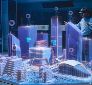
Point clouds play a key role in the digital visualization of everything from small individual components to entire buildings and neighborhoods. When combined with other 3D datasets, like BIM, and other project and asset information, point clouds can become even more valuable.
Transforming data into insights is the ultimate goal of gathering information like point clouds. The right software solution can bring 3D datasets and additional information together in a way that fosters collaboration and provides a single source of truth.
JP Interactive Viewer does exactly that, providing one system to store and connect all project, operational, KPI, analytics, modeling, and other data. The result is an end-to-end digital twin solution — a full and complete model of your organization’s facilities or its projects.